
Anderson ZIP Code Coverage
Anderson has six documented mailing or delivery labels that matter in local address work: 29621, 29622, 29623, 29624, 29625, and 29626. They are not six interchangeable slices of Anderson City. The Anderson County road atlas and Census search support a relationship for several labels, while the USPS grouping supplies mailing-label context for others. An Anderson delivery result still depends on the exact address. The table keeps the distinctions visible instead of giving each label a made-up neighborhood boundary or post-office assignment.
| ZIP | Areas Covered | Post Office | Notes |
|---|---|---|---|
| 29621 | Anderson city and county roads; Census ZCTA relation verified. | USPS grouping uses an Anderson 29623 label. | Use an address lookup for delivery ZIP and ZIP+4. |
| 29622 | Anderson mailing label verified in USPS grouping. | Grouped with 29625 and 29626 under an Anderson 29625 label. | City-limit coverage is not established by that grouping. |
| 29623 | USPS label group connects it with 29621. | Anderson 29623 label in USPS grouping. | Delivery, PO-box, or unique status was not verified. |
| 29624 | Anderson road-atlas and Census ZCTA relation verified. | No station name was verified in the research. | Check the municipal-boundary layer for jurisdiction. |
| 29625 | Anderson road-atlas and Census ZCTA relation verified. | Anderson 29625 USPS grouping label. | A delivery address remains necessary. |
| 29626 | Wider county postal area with Anderson road-atlas and ZCTA relation. | No station name was verified in the research. | Do not presume it lies inside the City. |
Two county labels show why the Anderson ZIP code directory should not expand into every nearby code. The Atlas Map Book identifies La France 29656 and Sandy Springs 29677 as post-office-box-only codes. They are useful counterexamples, not Anderson City residential delivery ZIPs. A USPS grouping can establish that a label is associated with Anderson without telling whether a particular road receives that code. Census ZCTAs also cover a statistical area, not a mail route. Keep the source and its purpose beside each conclusion.
For an Anderson address near a boundary, retain the full mailing result, the date checked, and the parcel identifier. That small record of the process makes it possible to revisit a discrepancy when an Anderson map, deed, or City layer uses a different geography. The Anderson County Atlas Map Book supports road and community context, but it is not a substitute for an address-specific USPS result. Note: The available sources do not publish a complete postal-boundary map for each Anderson mailing label.
Anderson ZIP Codes Need Checks
USPS delivery geography is address-specific. Its City/State material groups labels, but the address tool supplies the standardized mailing address and its ZIP or ZIP+4. That is a mailing result, not a legal municipal decision. USPS also warns that an address lookup cannot guarantee that a displayed address is a business's actual location. For Anderson records work, use the postal answer as the first identifier and preserve the complete standardized address for the next step.
The official USPS ZIP Code Lookup is the proper starting screen when the delivery ZIP is uncertain.
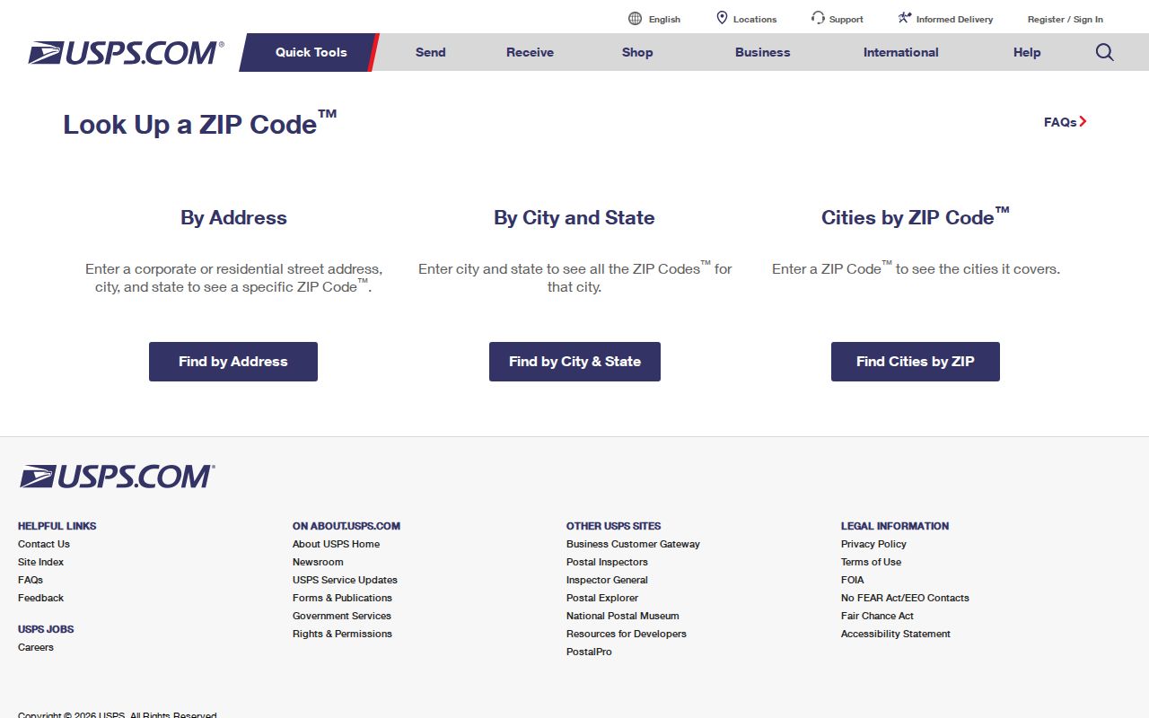
The USPS screen supports an address-level check, which is more precise than assigning a ZIP from an Anderson city name alone. Keep that Anderson delivery result with the street address before opening a county record.
Note: Postal standardization can confirm a mailing format without proving City jurisdiction or a person's physical presence.
Anderson ZIP Directory After USPS
After USPS returns a delivery ZIP, move to the Anderson County Property Viewer. The open Anderson map can locate an E911 address and then the parcel that contains it. Its municipal-boundary layer separates the Anderson City question from the postal question. The viewer is updated daily, yet the county says it is not the official record. Use it to find the geographic key, then consult the Anderson Assessor, Anderson Register of Deeds, or other responsible office for the record itself.
The Anderson E911 address, Anderson tax-map number, and Anderson municipal boundary can point to different systems without conflicting. They are separate identifiers for the same place.
Find an Anderson ZIP Code
There is no verified ZIP-wide query in ACPASS or the GIS Viewer. ACPASS documents Owner Name, Taxmap, and Street Name modes after its login gate. The Viewer documents address, road, TMS, deed, value, sales, and subdivision paths, while its map data can display a ZIP attribute. Neither source documents a search box or filter that returns all people, parcels, or records in one ZIP. Use a ZIP as a way to confirm an individual address, not as a resident list.
- Enter the full Anderson delivery address in the USPS lookup and retain the standardized result.
- Enter that address in the Property Viewer, which searches E911 addresses before locating the parcel.
- Check the Anderson map's municipal-boundary layer and record the TMS or tax-map number for the selected parcel.
- Use the TMS, street name, or owner-last-name route in Anderson ACPASS when access is available, then request the cited recorded instrument from the Anderson Register of Deeds if needed.
- Use the verified street and parcel facts for a narrower address review rather than asserting a ZIP-wide match.
City and county address administration adds another check. County GIS/E911 maintains street, address, and parcel information with Assessor data, but City of Anderson addresses use the City's separate OpenGov path and county address assignment when prompted. That division explains why a postal result alone cannot identify the government office that holds a later permit, code, or parcel record. First establish the delivery address. Then establish jurisdiction with the boundary layer and the date of the record.
Once an Anderson ZIP has narrowed the area to a street, the Anderson street directory follows the address and deed trail in more detail.
Anderson ZIP Fields in GIS
The Property Viewer help identifies the fields it actually documents. Its Address search first checks E911 address points. A selected match then opens the parcel process, and multiple address points may belong to one parcel. Road, Tax Map Grid, Subdivision, and Market Value are also documented tools. ZIP appears as a visible map attribute in data, but the research did not verify it as a search input. That difference matters when an Anderson ZIP code directory result is being tested against a parcel.
| Field or tool | Input or behavior | ZIP relevance |
|---|---|---|
| Address | Searches E911 addresses, then the containing parcel. | Use after USPS confirms a delivery address. |
| Road | Basic street search. | Locates a road, not a ZIP-wide record set. |
| Tax Map Grid | Available through Bookmarks. | Maps geography without creating a ZIP query. |
| Market Value | Advanced numeric field; no characters allowed. | Not a postal field. |
| Subdivision | Type selector and autocomplete after three letters. | Not a postal field. |
Anderson ACPASS is a second channel, not a replacement for this map. The Anderson Assessor's published instructions direct a user through Real Property and Property Search, but the post-login controls were not publicly observable. The distinction protects against a common error: treating a visible ZIP attribute as proof that the map can retrieve every parcel sharing it. The evidence supports viewing the attribute after a result, not running a postal-area search. For Anderson records, save the returned TMS and use the appropriate office's record procedure.
Anderson ZIP Directory Limits
The local Anderson systems have clear limits. The open Anderson GIS map is a locator, not the county's official record. Anderson ACPASS currently directs a visitor to email and password registration before the property-search interface. County permit PDFs show full project addresses and TMS values, but no documented ZIP control. MySCVotes is an authenticated personal voter service, not an anonymous postal-area browser. An Anderson City or county mailing label therefore cannot be converted into a list of everyone connected to it.
For an Anderson record that is not available online, the custodian is the fallback. The Anderson County FOIA request route asks for a specific department and a narrow description. South Carolina FOIA has distinct response periods, so describe the Anderson address, date span, TMS, and type of record rather than requesting an undefined ZIP search.
Note: A map's owner or mailing field may differ from the E911 physical address and does not establish a household roster.
North Anderson ZIP History
North Anderson adds a time-based caution to postal and City research. Its first 200-house plot dates to 1913. Water and power, then sewer, arrived in 1915, and the area was annexed in 1928 in the City's largest land annexation. A pre-1928 address there can have a different municipal trail even when a modern mailing label says Anderson. Start with the record date, then compare the parcel, deed, map, and boundary evidence for that period.
This history does not document a ZIP realignment or a citywide street-renumbering event. Neither was verified in the sources. The safest Anderson approach is to use dated records and the municipal-boundary layer instead of attaching a present postal area to an earlier jurisdiction.
Anderson ZIP Code Boundaries
A USPS delivery ZIP, an Anderson City limit, and a Census ZCTA are different map types. USPS routes mail. The City boundary identifies municipal jurisdiction. A ZCTA is a Census statistical area and should not be treated as a legal City line. The county road atlas is also a useful reference, but it does not replace a postal-boundary decision. For a current Anderson address, let USPS answer delivery, then use County GIS for jurisdiction and use the TMS plus legal description for record matching.
- ZIP code and ZIP+4
- A ZIP code is the main USPS postal routing code. ZIP+4 adds a smaller delivery segment to the standardized address.
- PO-box ZIP
- A code used for post-office boxes rather than ordinary street delivery. The county atlas identifies 29656 and 29677 as local examples outside Anderson City coverage.
- Unique ZIP
- A code assigned to one organization or site. No Anderson unique ZIP was verified in the available sources.
- Carrier route
- A delivery sequence within a postal area. It is not a City boundary or a record-search field documented in local portals.
Physical, mailing, and legal descriptions also serve different purposes. The legal description in a deed can keep a parcel trail intact when a label, boundary, or street address changes.